Causes of earthquakes and consequences. Nature of earthquakes
Mountain building, volcanic and seismic processes geographically gravitate towards each other. However, in time they occur, as a rule, non-simultaneously and always with different duration. In addition, there are areas with only pronounced seismic activity. For example, many of Central Asia are highly seismic, but do not have volcanoes. In Kamchatka and Chile, volcanoes and earthquakes occur in the same area, but rarely at the same time.
Many of the seismologists, speaking about the mechanism of earthquakes, adhere to the theory of elastic release or elastic recoil. They attribute the occurrence of earthquakes to the sudden release of elastic deformation energy. As a result of long-term movements in the fault area and the accumulation of stresses in connection with this, reaching the ultimate strength of rocks, a rupture or shear of these rocks occurs with a sudden rapid displacement - elastic recoil, as a result of which seismic waves arise. Thus, very slow and long tectonic movements during an earthquake turn into seismic movements, which are characterized by high speed, which occurs as a result of a rapid "discharge" of the accumulated elastic energy. This discharge occurs in just 10-15 seconds (rarely 40-60 seconds).
When an earthquake occurs, the rock is destroyed in a limited area located at a certain depth from the Earth's surface. In connection with the resulting weakening, a dislocation develops to the source or the hypocentral part of the earthquake region. The destruction will occur where the rock is least strong, and this may be in the faults between the blocks. Due to some deep processes, individual sections of the cortex rise or fall. With slow displacement, plastic deformations occur in the earth's crust. With faster movements and with their greater gradient, the stresses that arise in the cortex, without having time to dissolve, reach values at which, under the given conditions, discontinuity occurs - either along a ready, partly already healed gap, or with the formation of a new one. With increasing depth, all-round compressive stresses increase, and therefore large friction forces arise that prevent rapid destruction. Perhaps for this reason, deep-focus earthquakes are characterized by high energy and duration.
At present, two models of the propagation of forces causing a gap in the focus are most common. The first is based on the assumption that a pair of forces act in the focus, causing tangential forces along the discontinuity line and a moment; According to the second model, there are two mutually perpendicular pairs of forces in the source zone.
In addition to earthquakes caused by tectonic movements in the earth's crust and in the upper layers of the mantle, there are two other types of earthquakes due to volcanic eruptions and karst phenomena, which are very local, rare and of little force. Earthquakes can be caused by artificial means, such as an underground explosion. Ground vibrations can also be caused by the operation of industrial equipment, traffic, etc. When using sensitive equipment, you can make sure that the surface of the earth is constantly fluctuating; these oscillations are very small and for this reason are called microseismic. The presence of microseisms makes it possible to extract very useful information for both seismologists and civil engineers.
Thus, in a broad sense, the term earthquake can be understood as any shaking of the Earth's surface. In a narrower sense, an earthquake is understood as a short-term shaking of the Earth's surface caused by seismic waves arising from a local discontinuity with a sudden release of elastic energy in the bowels of the crust or upper mantle (to a depth of about 700 km).
At some point of the earthquake, there is an obstacle to the mutual displacement of blocks along the formed seams - the bonds of the broken seam are partially restored, which can be friction forces (their appearance is possible in compressed areas), engagement on surfaces. The unreleased part of the energy causes tensions in new bonds, which after a while will overcome their resistance, a new gap and a new push arise, but of lesser force than at the time of the main earthquake. These aftershocks - aftershocks - after a strong earthquake are usually up to several hundred and they occur for several months, gradually weakening. The process of weakening shocks in time is not uniform. Separate aftershocks can approach the strength of the main earthquake in strength. Sometimes earthquakes are preceded by weak shocks - foreshocks.
In those cases when earthquakes or volcanoes occur under the ocean floor, they excite sea waves, which, reaching the shores of the land and meeting their resistance, rise to a height of up to several tens of meters. Such waves - tsunamis (in Japanese "tsu" - port, "nami" - wave) - at times bring great trouble to coastal areas.
There are two groups of seismic waves - body and surface. The rocks that make up the Earth are elastic and therefore can be deformed and oscillate when pressure (loads) is applied sharply. Body waves propagate inside the volume of rocks. They are divided into two types: longitudinal and transverse. Longitudinal waves in the body of the Earth, like the usual sound waves in the air, alternately compress and stretch the substance of rocks in the direction of their movement. Waves of another type oscillate the medium through which they pass, across the path of their movement. It is they who, coming to the surface, sway from side to side and up and down everything that is on the ground, leading to the greatest destruction. Precisely because the surface of the solid Earth is the boundary with a much less dense medium, air (it is called the free surface), on the earth's surface, body seismic waves can "roam" more freely, which usually happens. This is facilitated by the properties of near-surface soils.
The properties of different groups and types of seismic waves are very important, especially the speed of their passage through rocks. It is usually measured in several kilometers per second and, therefore, at different distances from the source (hypocenter and epicenter), the arrival of waves is felt and recorded non-simultaneously. This property is the basis for determining the coordinates of the epicenter from the records of wave arrivals at remote seismic stations. Equally important are the differences in the velocities of individual groups and types of waves. Thus, surface waves propagate more slowly than body waves and, therefore, arrive at observation points later. In the group of body transverse waves, they propagate on average 1.75 times slower than longitudinal waves. From this it is clear why people who find themselves in the epicentral region of a strong earthquake often fall into the power of waves: they are pushed, shaken, shaken in different directions with different accelerations.
Eyewitnesses often "hear" earthquakes in the literal sense of the word. Longitudinal waves are similar to sound waves. At a certain frequency of vibrations (in the range of audible waves, that is, more than 15 hertz), when they reach the surface, they become sound waves. If we remember that longitudinal waves propagate faster, and transverse waves often carry the main damage, it is easy to understand why a rumble can be heard before an earthquake. Here much depends on the emission spectra.
Earthquakes are classified according to the depth of their source. They are divided into the following three types: 1) normal - with a focus depth of 0-70 km; 2) intermediate - 70-300 km; 3) deep-focus - more than 300 km.
The earthly firmament has always been a symbol of security. And today, a person who is afraid of flying on an airplane feels protected only when he feels a flat surface under his feet. Therefore, it becomes the most terrible thing when, literally, the soil leaves from under your feet. Earthquakes, even the weakest ones, undermine the sense of security so much that many of the consequences are not of destruction, but of panic and are psychological, not physical. In addition, this is one of those disasters that humanity cannot prevent, and therefore many scientists are studying the causes of earthquakes, developing methods for fixing shocks, forecasting and warning. The amount of knowledge already accumulated by humanity on this issue allows minimizing losses in some cases. At the same time, the examples of earthquakes in recent years clearly indicate that there is still a lot to be learned and done.
The essence of the phenomenon
At the heart of each earthquake is a seismic wave, resulting in It arises as a result of powerful processes of various depths. Quite minor earthquakes occur due to surface drift, often along faults. Deeper in their location, the causes of earthquakes often have devastating consequences. They flow in zones along the edges of shifting plates that are subducting into the mantle. The processes taking place here lead to the most noticeable consequences.
Earthquakes happen every day, but people don't notice most of them. They are only fixed with special devices. In this case, the greatest force of shocks and maximum destruction occur in the epicenter zone, the place above the focus that generated seismic waves.
Scales
Today, there are several ways to determine the strength of the phenomenon. They are based on such concepts as the intensity of an earthquake, its energy class and magnitude. The last of these is a value that characterizes the amount of energy released in the form of seismic waves. This method of measuring the strength of a phenomenon was proposed in 1935 by Richter and therefore is popularly called the Richter scale. It is still used today, but, contrary to popular belief, each earthquake is assigned not points, but a certain magnitude.
Earthquake scores, which are always given in the description of the consequences, refer to a different scale. It is based on a change in the amplitude of the wave, or the magnitude of the fluctuations in the epicenter. The values of this scale also describe the intensity of earthquakes:
- 1-2 points: rather weak tremors, recorded only by instruments;
- 3-4 points: noticeable in high-rise buildings, often noticeable by the swinging of a chandelier and the displacement of small objects, a person may feel dizzy;
- 5-7 points: shocks can be felt already on the ground, cracks may appear on the walls of buildings, shedding of plaster;
- 8 points: powerful shocks lead to the appearance of deep cracks in the ground, noticeable damage to buildings;
- 9 points: the walls of houses are destroyed, often underground structures;
- 10-11 points: such an earthquake leads to collapses and landslides, the collapse of buildings and bridges;
- 12 points: leads to the most catastrophic consequences, up to a strong change in the landscape and even the direction of water movement in rivers.
Earthquake scores, which are given in various sources, are determined precisely on this scale.
Classification
The ability to predict any disaster is linked to a clear understanding of what causes it. The main causes of earthquakes can be divided into two large groups: natural and artificial. The former are associated with changes in the bowels, as well as with the influence of some cosmic processes, the latter are caused by human activity. The classification of earthquakes is based on the cause that caused it. Among the natural ones, tectonic, landslide, volcanic and others are distinguished. Let's dwell on them in more detail.
Tectonic earthquakes
The crust of our planet is constantly in motion. This is what causes most earthquakes. The tectonic plates that make up the crust move relative to each other, collide, diverge and converge. In places of faults, where plate boundaries pass and a compression or tension force arises, tectonic stress accumulates. Growing, sooner or later, it leads to the destruction and displacement of rocks, as a result of which seismic waves are born.
Vertical movements lead to the formation of dips or uplift of rocks. Moreover, the displacement of the plates can be insignificant and amount to only a few centimeters, but the amount of energy released in this case is sufficient for serious destruction on the surface. Traces of such processes on earth are very noticeable. These can be, for example, displacements of one part of the field relative to another, deep cracks and dips.

Under the water
The causes of earthquakes at the bottom of the ocean are the same as on land - the movements of lithospheric plates. Their consequences for people are somewhat different. Very often, the displacement of oceanic plates causes a tsunami. Having originated above the epicenter, the wave gradually gains height and often reaches ten meters near the coast, and sometimes fifty.
According to statistics, over 80% of tsunamis hit the shores of the Pacific Ocean. Today, there are many services in seismic zones, working on predicting the occurrence and propagation of destructive waves and alerting the population of danger. However, people are still little protected from such natural disasters. Examples of earthquakes and tsunamis at the beginning of our century are another confirmation of this.

Volcanoes
When it comes to earthquakes, involuntarily, images of the eruption of red-hot magma that were once seen appear in the head. And this is not surprising: two natural phenomena are interconnected. An earthquake can be caused by volcanic activity. The contents of the fiery mountains exert pressure on the surface of the earth. During the sometimes quite long period of preparation for the eruption, periodic explosions of gas and steam occur, which generate seismic waves. The pressure on the surface creates the so-called volcanic tremor (tremor). It is a series of small ground shaking.
Earthquakes are caused by processes occurring in the depths of both active volcanoes and extinct ones. In the latter case, they are a sign that the frozen fiery mountain can still wake up. Volcanic researchers often use micro-earthquakes to predict eruption.
In many cases, it is difficult to unambiguously attribute an earthquake to a tectonic or volcanic group. The signs of the latter are the location of the epicenter in the immediate vicinity of the volcano and a relatively small magnitude.

collapses
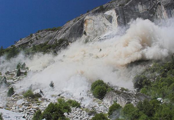
An earthquake can also be caused by the collapse of rocks. in the mountains arise as a result of various processes in the bowels and natural phenomena, as well as human activity. Hollows and caves in the ground can collapse and generate seismic waves. The collapse of rocks is facilitated by insufficient drainage of water, which destroys seemingly solid structures. The collapse could also be caused by a tectonic earthquake. The collapse of an impressive mass in this case causes insignificant seismic activity.
Such earthquakes are characterized by a small force. As a rule, the volume of collapsed rock is not enough to cause significant vibrations. Nevertheless, sometimes earthquakes of this type lead to noticeable damage.
Classification by depth of occurrence
The main causes of earthquakes are associated, as already mentioned, with various processes in the bowels of the planet. One of the options for classifying such phenomena is based on the depth of their origin. Earthquakes are divided into three types:
- Surface - the source is located at a depth of no more than 100 km, approximately 51% of earthquakes belong to this type.
- Intermediate - the depth varies in the range from 100 to 300 km, the sources of 36% of earthquakes are located on this segment.
- Deep-focus - below 300 km, this type accounts for about 13% of such disasters.
The most significant marine earthquake of the third type occurred in Indonesia in 1996. Its center was located at a depth of more than 600 km. This event allowed scientists to "enlighten" the bowels of the planet to a considerable depth. In order to study the structure of the subsoil, almost all deep-focus earthquakes that are not dangerous for humans are used. Many data on the structure of the Earth were obtained as a result of studying the so-called Wadati-Benioff zone, which can be represented as a curved inclined line indicating the place where one tectonic plate enters under another.

Anthropogenic factor
The nature of earthquakes has changed somewhat since the beginning of the development of technical knowledge of mankind. In addition to natural causes that cause tremors and seismic waves, artificial ones also appeared. A person, mastering nature and its resources, as well as increasing technical power, by his activity can provoke a natural disaster. The causes of earthquakes are underground explosions, the creation of large reservoirs, the extraction of large volumes of oil and gas, resulting in voids underground.
One of the rather serious problems in this regard is earthquakes arising from the creation and filling of reservoirs. Huge in terms of volume and mass, the water column exerts pressure on the bowels and leads to a change in the hydrostatic equilibrium in the rocks. Moreover, the higher the created dam, the greater the likelihood of the so-called induced seismic activity.
In places where earthquakes occur for natural reasons, often human activity is superimposed on tectonic processes and provokes the occurrence of natural disasters. Such data imposes a certain responsibility on companies involved in the development of oil and gas fields.

Consequences
Strong earthquakes cause great destruction over vast areas. The catastrophicity of the consequences decreases with distance from the epicenter. The most dangerous results of destruction are various. The collapse or deformation of industries associated with hazardous chemicals leads to their release into the environment. The same can be said about burial grounds and nuclear waste disposal sites. Seismic activity can cause contamination of vast areas.
In addition to the numerous destruction in cities, earthquakes have consequences of a different nature. Seismic waves, as already noted, can cause collapses, mudflows, floods and tsunamis. Earthquake zones after a natural disaster often change beyond recognition. Deep cracks and sinkholes, soil erosion - these and other "transformations" of the landscape lead to significant environmental changes. They can lead to the death of the flora and fauna of the area. This is facilitated by various gases and metal compounds coming from deep faults, and simply by the destruction of entire sections of the habitat zone.
Strong and Weak
The most impressive destruction remains after mega-earthquakes. They are characterized by a magnitude of over 8.5. Such disasters are, fortunately, extremely rare. As a result of such earthquakes, some lakes and riverbeds were formed in the distant past. A picturesque example of the "activity" of a natural disaster is Lake Gek-Gol in Azerbaijan.
Weak earthquakes are a hidden threat. As a rule, it is very difficult to find out about the probability of their occurrence on the ground, while phenomena of more impressive magnitude always leave identification marks. Therefore, all industrial and residential facilities near seismically active zones are under threat. Such structures include, for example, many nuclear power plants and power plants in the United States, as well as burial sites for radioactive and toxic waste.

Earthquake regions
The uneven distribution of seismically hazardous zones on the world map is also associated with the peculiarities of the causes of a natural disaster. There is a seismic belt in the Pacific Ocean, with which, one way or another, an impressive part of earthquakes is connected. It includes Indonesia, the western coast of Central and South America, Japan, Iceland, Kamchatka, Hawaii, the Philippines, the Kuriles and Alaska. The second most active belt is the Eurasian one: the Pyrenees, the Caucasus, Tibet, the Apennines, the Himalayas, Altai, the Pamirs and the Balkans.
The earthquake map is full of other areas of potential danger. All of them are associated with places of tectonic activity, where there is a high probability of collision of lithospheric plates, or with volcanoes.
The earthquake map of Russia is also full of a sufficient number of potential and active sources. The most dangerous zones in this sense are Kamchatka, Eastern Siberia, the Caucasus, Altai, Sakhalin and the Kuril Islands. The most destructive earthquake in recent years in our country occurred on Sakhalin Island in 1995. Then the intensity of the disaster was almost eight points. The disaster led to the destruction of a large part of Neftegorsk.
The huge danger of a natural disaster and the impossibility of preventing it forces scientists around the world to study earthquakes in detail: the causes and consequences, "identification" signs and forecasting capabilities. Interestingly, technological progress, on the one hand, helps to more accurately predict terrible events, to capture the slightest changes in the internal processes of the Earth, and on the other hand, it also becomes a source of additional danger: accidents at hydroelectric and nuclear power plants, in mining sites, horrendous industrial fires. The earthquake itself is a phenomenon as ambiguous as scientific and technological progress: it is destructive and dangerous, but it indicates that the planet is alive. According to scientists, the complete cessation of volcanic activity and earthquakes will mean the death of the planet in geological terms. The differentiation of the bowels will be completed, the fuel that has been heating the interior of the Earth for several million years will run out. And it is not yet clear whether there will be a place for people on the planet without earthquakes.
Earthquakes are tremors and vibrations of the Earth's surface caused by natural causes (mainly tectonic processes), or (sometimes) by artificial processes (explosions, filling of reservoirs, collapse of underground mine workings). Small shocks can also be caused by the rise of lava during volcanic eruptions.
An earthquake of a tectonic type, i.e. associated with the internal endogenous forces of the Earth, is a process of cracking, going at some finite rate, and not instantly. It involves the formation and renewal of many ruptures of different scales, with the ripping of each of them not only with the release, but also with the redistribution of energy in a certain volume. When we talk about the fact that the force of external impact on rocks exceeded their strength, it should be borne in mind that geomechanics clearly distinguish between the strength of rocks as a material, which is relatively high, and the strength of a rock mass, which includes, in addition to rock material, also structural weakened areas. Due to the latter, the strength of the rock mass is significantly lower than the strength of the rocks themselves.
The rupture propagation speed is several km/s, and this destruction process covers a certain volume of rocks, which is called the earthquake source. The hypocenter is the center of the focus, conditionally a point source of short-period oscillations.
Physico-chemical processes occurring inside the Earth cause changes in the physical state of the Earth, volume and other properties of matter. This leads to the accumulation of elastic stresses in any area of the globe. When the elastic stresses exceed the tensile strength of the substance, there will be a rupture and displacement of large masses of the earth, which will be accompanied by tremors of great force. This is what causes the shaking of the Earth - an earthquake.
An earthquake is also usually called any oscillation of the earth's surface and bowels, no matter what causes it is caused - endogenous or anthropogenic, and whatever its intensity.
Earthquakes do not occur everywhere on Earth. They are concentrated in relatively narrow belts, confined mainly to high mountains or deep oceanic trenches. The first of them - the Pacific - frames the Pacific Ocean; the second - the Mediterranean-Trans-Asian - extends from the middle of the Atlantic Ocean through the Mediterranean Sea basin, the Himalayas, East Asia up to the Pacific Ocean; finally, the Atlantic-Arctic belt captures the mid-Atlantic submarine ridge, Iceland, Jan Mayen Island and the submarine Lomonosov Ridge in the Arctic, etc.
Earthquakes also occur in the zone of African and Asian basins, such as the Red Sea, Lakes Tanganyika and Nyasa in Africa, Issyk-Kul and Baikal in Asia.
The fact is that the highest mountains or deep oceanic trenches on a geological scale are young formations that are in the process of formation. The earth's crust in such areas is mobile. The vast majority of earthquakes are associated with mountain building processes. Such earthquakes are called tectonic. Scientists have compiled a special map showing the magnitude of earthquakes that occur or can occur in different parts of our country: in the Carpathians, in the Crimea, in the Caucasus and Transcaucasia, in the Pamir, Kopet-Dag, Tien Shan, Western and Eastern Siberia mountains , Baikal, Kamchatka, the Kuril Islands and the Arctic.
There are also volcanic earthquakes. Lava and hot gases seething in the bowels of volcanoes press on the upper layers of the Earth, like boiling water vapor on the lid of a teapot. Volcanic earthquakes are rather weak, but last for a long time: weeks and even months. There have been cases when they occur before volcanic eruptions and serve as harbingers of disaster.
Ground shaking can also be caused by rockfalls and large landslides. These are local landslide earthquakes.
As a rule, strong earthquakes are accompanied by aftershocks, the power of which gradually decreases.
During tectonic earthquakes, ruptures or movements of rocks occur in some place deep in the Earth, called the earthquake focus or hypocenter. Its depth usually reaches several tens of kilometers, and in some cases hundreds of kilometers. The area of the Earth located above the focus, where the force of tremors reaches its greatest value, is called the epicenter.
Sometimes disturbances in the earth's crust - cracks, faults - reach the surface of the Earth. In such cases, bridges, roads, structures are torn and destroyed. An earthquake in California in 1906 created a crack 450 km long. Sections of the road near the crack shifted by 5-6 m. During the Gobi earthquake (Mongolia) on December 4, 1957, cracks appeared with a total length of 250 km. Ledges up to 10 m were formed along them. It happens that after an earthquake, large areas of land sink and are flooded with water, and waterfalls appear in places where ledges cross rivers.
How often do earthquakes occur on Earth? Modern precision instruments record more than 100,000 earthquakes every year. But people feel about 10 thousand earthquakes. Of these, about 100 are destructive.
The strength of the concussion, or the strength of the manifestation of an earthquake on the earth's surface, is determined by points. The most common is the 12-point scale. The transition from non-destructive to destructive shaking corresponds to 7 points.
The strength of the manifestation of an earthquake on the Earth's surface to a greater extent depends on the depth of the focus: the closer the focus is to the Earth's surface, the greater the strength of the earthquake at the epicenter. Destruction on the surface of the Earth depends, in addition to the energy released during an earthquake and the depth of the focus, also on the quality of the soil. The greatest destruction occurs on loose, damp and unstable soils. The quality of ground structures also matters.
Hundreds of thousands of earthquakes occur every year on our planet. Most of them are so small and insignificant that only special sensors can detect them. But, there are also more serious fluctuations: twice a month the earth's crust shudders strongly enough to destroy everything around.
Since most shocks of this magnitude occur at the bottom of the oceans, if they are not accompanied by a tsunami, people are not even aware of them. But when the land shudders, the elements are so destructive that the number of victims goes into the thousands, as happened in the 16th century in China (during earthquakes with a magnitude of 8.1, more than 830 thousand people died).
An earthquake is called tremors and vibrations of the earth's crust, caused by natural or artificially created causes (movement of lithospheric plates, volcanic eruptions, explosions). The consequences of shocks of great intensity are often catastrophic, second only to typhoons in the number of victims.
Unfortunately, at the moment, scientists have not studied the processes that take place in the bowels of our planet so well, and therefore the earthquake forecast is rather approximate and inaccurate. Among the causes of earthquakes, experts identify tectonic, volcanic, landslide, artificial and man-made fluctuations of the earth's crust.
Tectonic
Most of the earthquakes recorded in the world arose as a result of movements of tectonic plates, when there is a sharp displacement of rocks. This can be either a collision with each other, or lowering a thinner plate under another.
Although this shift is usually small, and is only a few centimeters, the mountains located above the epicenter begin to move, which release tremendous energy. As a result, cracks form on the earth's surface, along the edges of which huge tracts of land begin to shift along with everything that is on it - fields, houses, people.
Volcanic
But volcanic fluctuations, although weak, continue for a long time. Usually they do not pose a particular danger, but catastrophic consequences were still recorded. As a result of the most powerful eruption of the Krakatoa volcano at the end of the XIX century. half of the mountain was destroyed by the explosion, and the subsequent tremors were of such force that they split the island into three parts, plunging two thirds into the abyss. The tsunami that rose after that destroyed absolutely everyone who managed to survive before and did not have time to leave the dangerous territory.


landslide
It is impossible not to mention collapses and large landslides. Usually these concussions are not strong, but in some cases their consequences are catastrophic. So, it happened once in Peru, when a huge avalanche, causing an earthquake, descended from Mount Askaran at a speed of 400 km / h, and, having leveled more than one settlement, killed more than eighteen thousand people.
man-made
In some cases, the causes and consequences of earthquakes are often associated with human activities. Scientists have recorded an increase in the number of tremors in areas of large reservoirs. This is due to the fact that the collected mass of water begins to put pressure on the underlying earth's crust, and the water penetrating through the soil destroys it. In addition, an increase in seismic activity has been observed in oil and gas production areas, as well as in the area of mines and quarries.
artificial
Earthquakes can also be caused artificially. For example, after the DPRK tested a new nuclear weapon, in many places on the planet, sensors recorded earthquakes of moderate strength.
An underwater earthquake occurs when tectonic plates collide on the ocean floor or near the coast. If the focus is shallow, and the magnitude is 7 points, an underwater earthquake is extremely dangerous because it causes a tsunami. During the shudder of the sea crust, one part of the bottom sinks, the other rises, as a result of which the water, in an attempt to return to its original position, begins to move vertically, generating a series of huge waves going towards the coast.

Such an earthquake, together with a tsunami, can often have catastrophic consequences. For example, one of the strongest seaquakes occurred a few years ago in the Indian Ocean: as a result of underwater shocks, a large tsunami rose and, having hit the nearby coasts, led to the death of more than two hundred thousand people.
Start of shocks
The focus of an earthquake is a gap, after the formation of which the earth's surface instantly shifts. It should be noted that this gap does not occur immediately. First, the plates collide with each other, as a result of which friction occurs and energy is generated, which gradually begins to accumulate.
When the stress reaches its maximum and begins to exceed the force of friction, the rocks are torn apart, after which the released energy is converted into seismic waves moving at a speed of 8 km / s and causing the earth to vibrate.

The characteristics of earthquakes according to the depth of the epicenter are divided into three groups:
- Normal - epicenter up to 70 km;
- Intermediate - epicenter up to 300 km;
- Deep focus - the epicenter at a depth exceeding 300 km, typical for the Pacific Rim. The deeper the epicenter, the farther the seismic waves generated by the energy will reach.
Characteristic
An earthquake consists of several stages. The main, most powerful shock is preceded by warning vibrations (foreshocks), and after it, aftershocks begin, subsequent shaking, and the magnitude of the strongest aftershock is 1.2 less than that of the main shock.
The period from the beginning of foreshocks to the end of aftershocks may well last several years, as, for example, happened at the end of the 19th century on the island of Lissa in the Adriatic Sea: it lasted three years and during this time scientists recorded 86,000 shocks.
As for the duration of the main shock, it is usually short and rarely lasts more than a minute. For example, the most powerful shock in Haiti, which occurred a few years ago, lasted forty seconds - and that was enough to reduce the city of Port-au-Prince to ruins. But in Alaska, a series of aftershocks was recorded that shook the earth for about seven minutes, while three of them led to significant destruction.


It is extremely difficult, problematic and there are no 100% ways to calculate what kind of push will be the main one and will have the greatest magnitude. Therefore, strong earthquakes often take the population by surprise. So, for example, it happened in 2015 in Nepal, in a country where mild shaking was recorded so often that people simply did not pay much attention to them. Therefore, a 7.9 magnitude ground tremor resulted in a large number of casualties, and weaker aftershocks of magnitude 6.6 that followed half an hour later and the next day did not improve the situation.
It often happens that the strongest tremors occurring on one side of the planet shake the opposite side. For example, a 2004 magnitude 9.3 earthquake in the Indian Ocean eased some of the rising stress on the San Andreas Fault, which lies at the junction of lithospheric plates along the coast of California. It turned out to be of such strength that it slightly changed the appearance of our planet, smoothing out its bulge in the middle part and making it more rounded.
What is magnitude
One of the ways to measure the amplitude of oscillations and the amount of energy released is the magnitude scale (Richter scale), containing arbitrary units from 1 to 9.5 (it is often confused with the twelve-point intensity scale, measured in points). An increase in the magnitude of earthquakes by only one unit means an increase in the amplitude of oscillations by a factor of ten, and an increase in energy by a factor of thirty-two.
The calculations performed showed that the size of the epicenter during weak surface oscillations, both in length and vertically, is measured in several meters, when of average strength - in kilometers. But earthquakes that cause catastrophes have a length of up to 1 thousand kilometers and go from the break point to a depth of up to fifty kilometers. Thus, the maximum recorded size of the epicenter of earthquakes on our planet was 1000 per 100 km.

The magnitude of earthquakes (Richter scale) looks like this:
- 2 - weak almost imperceptible fluctuations;
- 4 - 5 - although the shocks are weak, they can lead to minor damage;
- 6 - medium destruction;
- 8.5 is one of the strongest recorded earthquakes.
- The largest is the Great Chilean earthquake with a magnitude of 9.5, which gave rise to a tsunami, which, having overcome the Pacific Ocean, reached Japan, having overcome 17 thousand kilometers.
Focusing on the magnitude of earthquakes, scientists argue that out of tens of thousands of oscillations occurring on our planet per year, only one has a magnitude of 8, ten - from 7 to 7.9 and one hundred - from 6 to 6.9. Keep in mind that if the magnitude of the earthquake is 7, the consequences can be catastrophic.
intensity scale
To understand why earthquakes occur, scientists have developed a scale of intensity based on such external manifestations as the impact on people, animals, buildings, nature. The closer the epicenter of earthquakes to the earth's surface, the greater the intensity (this knowledge makes it possible to give at least an approximate forecast of earthquakes).
For example, if the magnitude of the earthquake was eight, and the epicenter was at a depth of ten kilometers, the intensity of the earthquake will be from eleven to twelve points. But if the epicenter was located at a depth of fifty kilometers, the intensity will be less and will be measured at 9-10 points.


According to the scale of intensity, the first destruction can occur already with six-point shocks, when thin cracks appear in the plaster. An earthquake of eleven points is considered catastrophic (the surface of the earth's crust is covered with cracks, buildings are destroyed). The strongest earthquakes that can significantly change the appearance of the area are estimated at twelve points.
What to do in case of earthquakes
According to rough estimates of scientists, the number of people who have died in the world due to earthquakes over the past half a millennium exceeds five million people. Half of them are in China: it is located in a zone of seismic activity, and a large number of people live on its territory (830 thousand people died in the 16th century, 240 thousand in the middle of the last century).


Such catastrophic consequences could have been prevented if earthquake protection had been well thought out at the state level, and the possibility of strong earthquakes was taken into account in the design of buildings: most people died under the rubble. Often people living or staying in a seismically active zone have no idea how exactly to act in an emergency and how you can save your life.
You need to know that if tremors caught you in a building, you need to do everything possible to get out into the open space as soon as possible, while using elevators is absolutely impossible.
If it is impossible to leave the building, and the earthquake has already begun, it is extremely dangerous to leave it, so you need to stand either in the doorway, or in the corner near the load-bearing wall, or climb under a strong table, protecting your head with a soft pillow from objects that may fall from above. After the tremors are over, the building must be left.
If during the beginning of earthquakes a person was on the street, you need to move away from the house at least one third of its height and, avoiding tall buildings, fences and other buildings, move in the direction of wide streets or parks. It is also necessary to stay as far as possible from broken electrical wires in industrial plants, as explosive materials or poisonous substances can be stored there.
But if the first tremors caught a person when he was in a car or public transport, you need to urgently leave the vehicle. If the car is in an open area, on the contrary, stop the car and wait out the earthquake.
If it so happened that you were completely overwhelmed with debris, the main thing is not to panic: a person can survive without food and water for several days and wait until they find him. After catastrophic earthquakes, rescuers work with specially trained dogs, and they are able to smell life among the rubble and give a sign.
15.08.2016
As noted earlier, lithospheric plates are continuously in the process of slow movements, as a result of which mechanically stressed regions appear at their boundaries. Sudden ruptures of these areas lead to an earthquake.
The boundaries of lithospheric plates are divided into separate large segments. Earthquakes in the section of this segment lead to a local decrease in voltage in this place, but partially transfers the voltage to neighboring segments, thereby preparing them for the next break - an earthquake. As J. Rice notes: “In fact, the study of earthquakes along large sections of seismically active belts (faults) leads to the conclusion that, perhaps, there is a quite definite regular pattern of the spatial distribution of areas of accumulation and unloading of stresses, so that the increase in stresses in one segment of a given seismic fault occurs not independently, but strongly related to the time-varying transmission of stresses from neighboring segments in which breaks have occurred. It is assumed that the front of the "trigger" mechanism of strong earthquakes along the seismic belts (plate boundaries) propagates at a certain speed (about 50-100 km/year for the northern part of the Anatolian fault).
During a strong earthquake, a large segment of the crust is torn, which causes a stress wave both in the upper layers of the asthenosphere and in sectors adjacent to the plate boundaries. Ho, as the asthenosphere relaxes (relaxes) in time, most of the stresses shift towards neighboring segments in the plate boundary, making them probable sites for subsequent large earthquakes (ruptures).
Let us consider in more detail the mechanism of formation of individual discontinuities. The gap can be vertical or oblique. The length of the ruptured part of the rupture can be from several meters (weak, imperceptible earthquakes) to hundreds of kilometers (strong earthquakes). A bursting crack can reach the Earth's surface or stop inside it (Fig. 1.5).
The place where it starts ripping called hypocenter earthquake, the vertical point above the hypocenter on the Earth's surface is called epicenter. The distance from the Earth's surface to the hypocenter is called focus depth earthquake, which is usually measured from a few kilometers to a hundred kilometers. The distance from the epicenter to a given observation point on the Earth's surface is called epicentral distance, and from the hypocenter to the observation point - focal length. Mutual movements of the ripping parts are divided into horizontal: left shift and right shift and for vertical ones: dump and throw(Fig. 1.16). In a left-hand shear, the ripping parts of the plates move horizontally one along the other so that distant part moves away from the observer to the left when viewed in a direction perpendicular to the discontinuity. With a right-hand shift, the opposite is true. If overlying part ripping rock is moving down - it is believed that there was reset(ledge), when moving up - took place uplift(thrust). During real earthquakes, the rocks are torn up taking into account various combinations of the above movements.
The direction of the horizontal line formed by the discontinuity at the intersection of the home surface is called strike, and the angle formed between stretch and the horizon, the angle of incidence. Amplitudes of relative shifts AB can be measured from a few centimeters to tens or more meters.
The time of ripping of rocks lasts for several seconds. In the process of ripping, a certain amount of kinematic energy arises, which is spent on breaking and destroying rocks, on horizontal and vertical movements of the plates. Part of this energy is converted into thermal energy, and a small part is dissolved in the medium in the form of elastic seismic waves that propagate in the body of the Earth. When seismic waves reach the Earth's surface, they cause ground vibrations that we perceive as an earthquake. Since seismic waves are generated not from one fixed point, but from the edges of the torn rocks of the whole area moving in different directions, they travel different paths and reach the Earth's surface in different directions and at different times. The properties of seismic waves will be discussed a little later. In the meantime, let's find out what kind of stress-strain field is formed on the Earth's surface at the initial moment of the earthquake.
Figure 1.17 shows a simplified diagram of the earthquake source, where the direction of the 0’0” line coincides with the direction of ripping, and the arrows show the directions of elastic displacements of the medium. It is curious what a person would feel at the very first moment of an earthquake, being in the epicentral zone of an earthquake. If he were in area a, then he would sway that he was being pushed, which means that the ground under his feet is being compressed. He would feel the same way if he were in area b. Ho, being in the region d and c, on the contrary, it would seem to him that the Earth is moving away from under his feet, i.e. the soil in these areas is subject to tension. At the moment of rupture, the upper wing of the torn rock drives a compression wave into area a, and an extension wave into area c, while the lower wing, on the contrary, drives a compression wave into area b, and an extension wave into area d.
Thus, the epicentral zone can be divided into four diagonally located zones, in two of which the first compression wave, and in the other two stretch wave(discharge). Along the direction of the crack (ripping), the movement of the medium is mutually balanced, and there are no displacements of the medium in this direction. It is logical that they will also be absent in the direction perpendicular to the discontinuity line. Since the displacements change their sign when crossing mutually perpendicular planes, they must be equal to zero on these planes themselves. These planes, which, when intersecting with the surface of the Earth, will not look like straight lines, but circles, are called nodal planes. Of great interest is the inverse problem: if areas of tension and compression on the Earth's surface in the epicentral zone are instrumentally recorded, then how to find the direction of the rupture. The answer to this question lies in drawing two mutually perpendicular planes, dividing the entire study area into two compression zones and two extension zones. One of these planes will be the direction of the break line. To unambiguously select one of them, it is necessary to involve additional information about the position of the fault according to tectonic data and other information.
The pattern of distribution of compression and tension zones on the Earth's surface played an important role in distinguishing an earthquake from underground nuclear explosions. In fact, during underground nuclear explosions, the first break signals of all seismic stations around the epicenter will correspond to only the compression zone in contrast to, as mentioned above, alternating zones of compression and tension during earthquakes. Ho despite such a clear evidence of this phenomenon, there are still disagreements between experts on the issue of distinguishing a nuclear explosion from an earthquake.